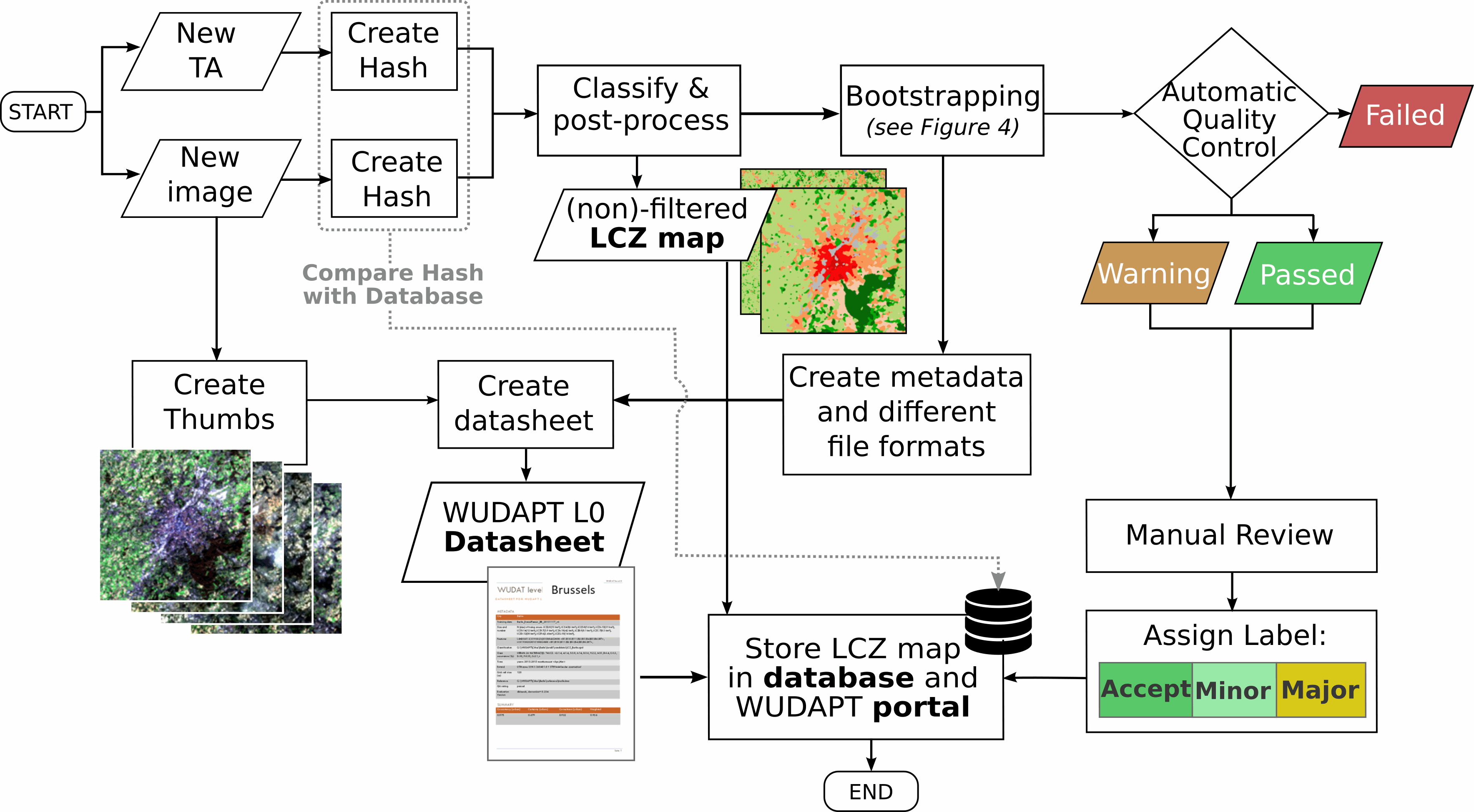
All submitted level zero contributions (LCZ training areas and maps) are undergoing a quality assessment (QA) in several stages as shown in the figure below.
Details can be found in:
Bechtel, B., Alexander, P.J., Beck, C., Böhner, J., Brousse, O., Ching, J., Demuzere, M., Fonte, C., Gál, T., Hidalgo, J., Hoffmann, P., Middel, A., Mills, G., Ren, C., See, L., Sismanidis, P., Verdonck, M.-L., Xu, G., Xu, Y., 2019. Generating WUDAPT Level 0 data – Current status of production and evaluation. Urban Climate 27, 24–45. https://doi.org/10.1016/j.uclim.2018.10.001
Once the maps passed the automated quality assessment, they are added to the WUDAPT portal and can be downloaded there. This comprises the maps (as GeoTIFF and KML) and meta data including the fact sheets and QA results. Data that did not pass the quality assessment, other file formats, as well as training data are available upon request.

Unfortunately, the quality assessment takes some time and in particular the manual review is greatly delayed due to missing funding. We appologise for any inconvieniance and hope for your understanding.
The originally submitted training data are directly available for download here. Please be aware that these data are as submitted and not quality checked at all.
Please make sure you attribute and acknowledge the author(s) appropriately.
Some old maps can be viewed (not downloaded) in Geopedia.
Thanks for all your contributions.